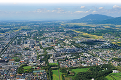
Tsukuba City is located approximately 50 kilometers from Tokyo and southwest of Ibaraki Prefecture. Except Mt. Tsukuba, which is located at north of the city, most part of the city has a flat terrain and is a rural area such as flat forest, upland, and paddy fields. Since the 1960s, its development has progressed as Tsukuba Science City, bringing together 32 national institutions and other research & educational institutions and has become the largest academic city in Japan with approximately 20,000 researchers utilizing world's most advanced facilities.
Tsukuba City : Living Information

| Name | Category | Map | Notes |
|---|---|---|---|
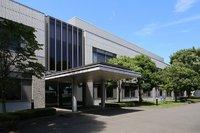
| Tsukuba City Hall | Administrative facilities | map |
Approx. 5 min. from TX Kenkyu-Gakuen Station |
|
Tsukuba Center & TX Tsukuba Station |
Bus terminal | map |
Approx. 50 min. from Narita Airport by Express bus |
| Ninomiya House | JST residence | map | Approx. 15 min. from Tsukuba Center by walk |
| Takezono House | JST residence | map | Approx. 10 min. from Tsukuba Center by walk |
| Midorino Station | Tsukuba Express | map |
Approx. 15 min. from the Dormitory for Trainees by car |
| Norin Danchi Chuo | Tsuku-bus | map | Approx. 20 min. from Tsukuba Center by bus |
| Tsukuba International House | Guest House | map | Approx. 22 min. from Tsukuba Center by bus |
| Tsukuba Clinic | Clinic | map | On NARO Tsukuba campus |
| Convenience Store | Daily necessities | map | |
| Supermarket | Food items | map | |
| Imported food items | map | ||
| Halal food items | map | ||
| Hardware store | Daily necessities | map | |
| Electronics retail store | Electric appliances | map | |
| Restaurant | Japanese | map | |
| Western | map | ||
| Chinese | map | ||
| Noodles | map | ||
| Fast food | map | ||
| Ethnic food | map | ||
| Hospital | General Hospital | map | Need a reservation generally |
| Clinic | map | ||
| Dentistry | map | Need a reservation generally | |
| Post office | map | ||
| Bank | map | ||
| Accomodation | map | ||
| Christian church | map | ||
| Mosque | map | ||
| Temple | map |
Related Links
Highest priority knowledge and information
Civil service
Medical institution
Education and Child care
- Yatabe Elementary School
- Takezono Higashi Elementary School
- Takezono Nishi Elementary School
- Ninomiya Elementary School