A new function and several databases useful for soil management utilizing various data were added to the "Digital Soil Map" available online. By using the soil organic matter management tool, a new function added to the resource, users can easily calculate the changes of the soil organic matter content, which is an indicator for soil management, from setting the supposed amount of organic materials such as compost to be applied to the selected soil type. Other additional features include the daily estimate of the temperature and the moisture of the soil at the two hundred monitoring sites and the soil profile information at the three thousand and five hundred sample sites throughout the country.
Overview
The "Digital Soil Map" is an open data developed by the National Agriculture and Food Research Organization (NARO) and has been available online at "Japanese Soil Inventory" website (https://soil-inventory.dc.affrc.go.jp/index.html) since April 2017. It offers a detailed information of the soil types in different spots and how various soil types are distributed throughout the country. There had been more than 150,000 visits to the "Digital Soil Map", and the various sets of data are efficiently and widely used for purposes such as improvement of farming practices. Recently, NARO has improved the resource by adding new function and three new databases as follows.
New function
- The soil organic matter management tool: Users can calculate how the soil organic matter contents in the specific location will change after applying fertilizers etc.
New database
- Database of the daily estimate of the temperature and the moisture of the soil at the two hundred monitoring sites. The data can be utilized for understanding the rate and/or pattern of the nutrient release from slow-release fertilizer and organic materials.
- Database of the soil profile information at the three thousand and five hundred sample sites. The information regarding the soil profile within one meter below the surface offers the characteristics of soil in each layer and is useful in planning fertilizer application and farm management.
- Database of the digital soil map based on the international classification (World Reference Base for Soil Resources, WRB). Since the original digital soil map is based on domestic classification, it is useful for comparing the international/ domestic classification.
Link to the Digital Soil Map
For Inquiries
Contact: http://www.naro.affrc.go.jp/english/inquiry/index.html
Reference Information

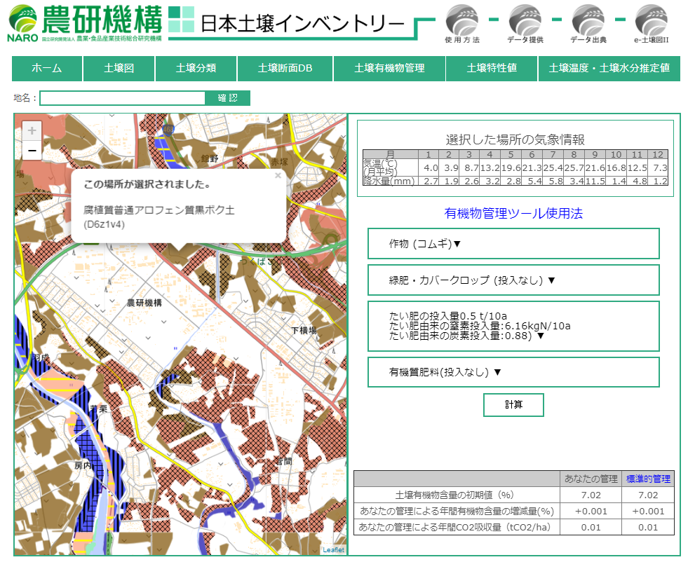
Fig.1 The soil organic matter management tool
First the user clicks on the soil map (on the left), and the classification name of soil in the specific location appears. At the same time, the weather and the soil information will be automatically set to the calculation model to estimate the soil organic matter contents to be decomposed. Then the user goes on to input the farming information starting from the name of the crop, use of green manure or not, the amount of compost, and to the amount of other organic materials. Finally, it will calculate the estimate of the changes in the soil organic matter contents resulting as the farming practice set by the user.
The above example shows if wheat is to be grown at the selected location where the soil is classified as "humicHaplic Allophanic Andosols", the amount of organic matter can be maintained when compost is applied at the ratio of 5t/ha.

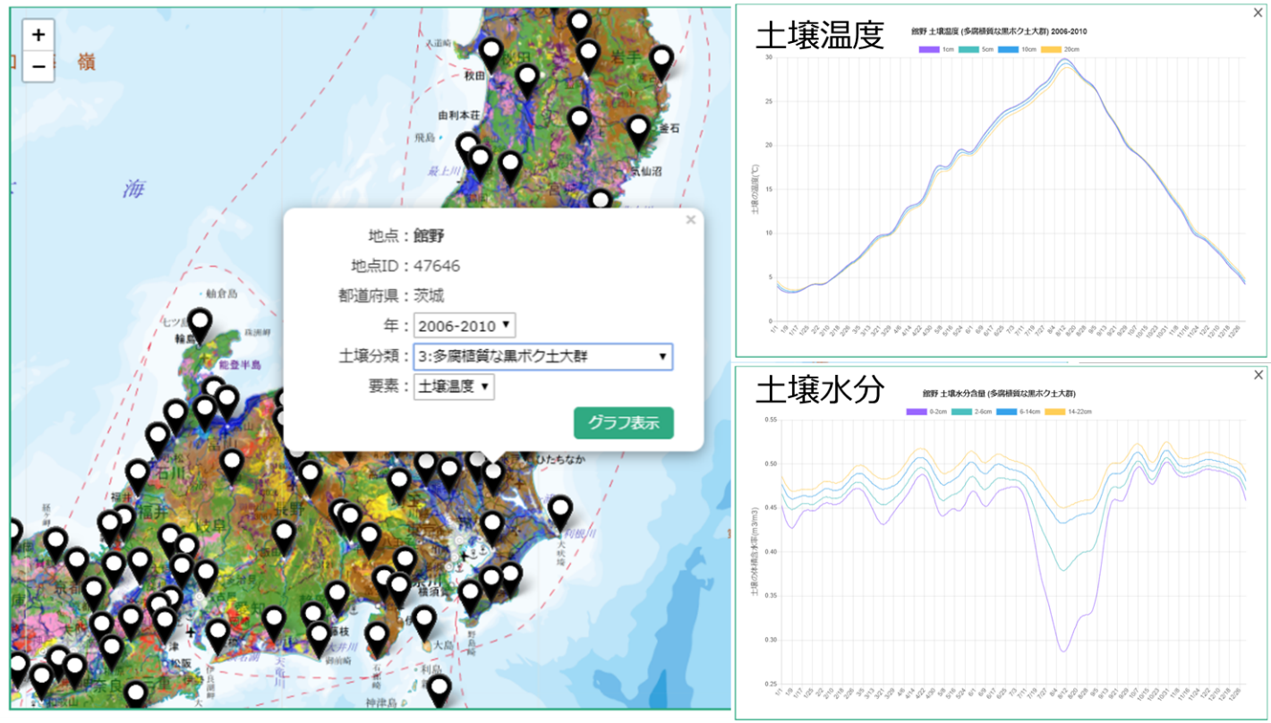
Fig.2 Example of the webpage showing the daily estimate of the temperature and the moisture at the selected spot
Estimate value of the temperature and moisture of the selected ten soil types at the two hundred monitoring sites are available. Users can select either the normal value of past 30 years or the average value of every five years in the past.

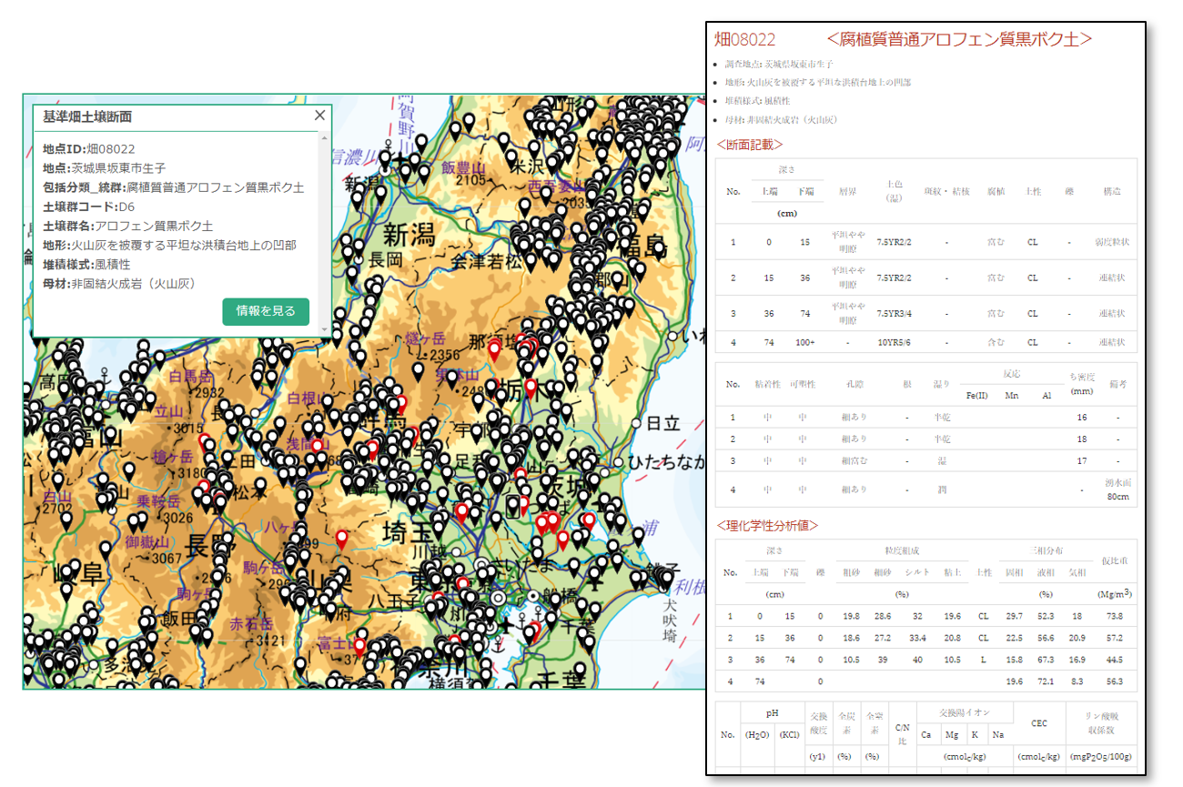
Fig.3 Example of the webpage showing soil profile information
Detailed information of each layer of soil within one meter below the surface: color of the soil, soil structure, various physicochemical analysis value (mechanical composition, three phases distribution, pH, total carbon/nitrogen content, exchangeable cation, cation exchange capacity, phosphate absorption coefficient) are available.

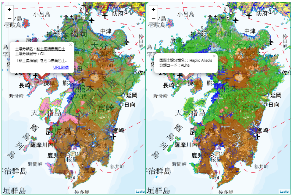
Fig.4 Example of the website showing the digital soil map based on the international classification
On the right: Soil map based on the international classification
On the left: Soil map based on the domestic classification


