We are enagged in the development of the following technologies for the maintenance and utilization of spatial information of agricultural infrastructure.
- We develop a technology to integrate and convert various data on agricultural infrastructure (farmland, agricultural irrigation facilities, etc.), and also an agricultural infrastructure digital platform that handles information from multiple facilities in an integrated manner and contributes to improving operational efficiency and promoting smart agriculture in Government-operated Project areas, etc.
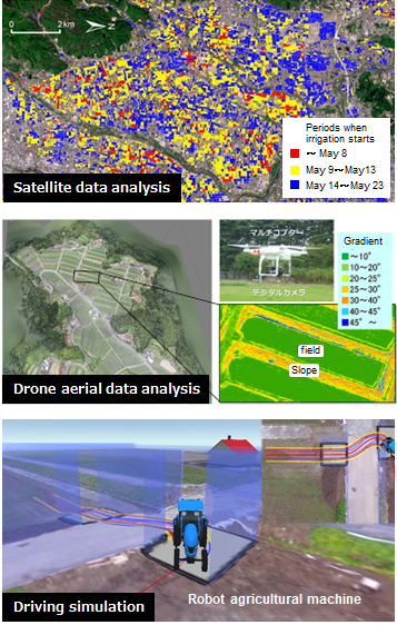
- We develop a design support tool for intelligent farms (smart farms) suitable for intelligent work using robot agricultural machines and provide information to understand the safety of smart farms from simulation results using virtual farms (three-dimensional models). In addition, we develop elemental technologies for 3D modeling to easily create virtual farms as a design support tool.
- We develop a technology to extract dangerous parts of agricultural land infrastructure around the field using sensing by drones and SfM(Structure from Motion) technology, in order to ensure smooth automatic unmanned operation of robot agricultural machines and work safety of farmers.
Members
- NOGUCHI Yasushi (Leader)
- MATSUSHIMA Kenichi (Deputy Leader)
- YOSHIMURA Akiko
- SHINOHARA Kengo
- FUJITA Yuuki