The Institute for Rural Engineering, NARO (NIRE) has developed a simulation method of various patterns of heavy rainfall (amount and intensity combined) which can occur in regions consisting mainly of rice fields in the future. Moreover, the method can assess the potential damage including the rice fields being submerged for the first time, and evaluate the risk of yield loss. It is also possible to estimate the changes in rainfall intensity and frequency of occurrence of heavy rain in the future, taking into consideration the impact of climate change. This simulation method will facilitate the development of a highly reliable and safe drainage system in the future.
Overview
The flooding due to heavy rain that has occurred in various areas such as Kinugawa in 2015 and Kyushu in 2017 also brought extensive damage in the agricultural sector. Heavy rain is one of the major cause for the reduction of yield especially for rice. Furthermore, risks due to heavy rainfall are expected to increase in the future due to climate change. Since early drainage is effective for reducing flood damage in rice fields, maintenance of scaled wastewater facilities responding to the future risk and planning of wastewater is necessary. However, it is difficult to accurately predict the future climate, hence at present it is difficult to predict accurate risks and to take appropriate measures based on that.
Therefore NARO has developed a method to estimate the intensity and frequency of heavy rain that can occur at present as well as the future in a specific areas. The potential damage in rice fields of that area is predicted, and a method is further proposed to clearly evaluate the results based on the amount (in tons) or percentage (%) of decreased rice yield. By adding statistical analysis based on results of prediction results of multiple climate change, this method can be used to quantitatively estimate the average damage as well as the largest scale of damage that can possibly occur.
This method can be applied to rice fields all over the country, and be used by government agencies related to agricultural land drainage and rural disaster prevention, private consultants, land improvement zones, etc. in developing a highly safe drainage system in the future. In addition, since it is possible to predict the intensity and occurrence frequency of heavy rain in a specific area, it can useful not only for estimating the risk of rice damage, but also for creating farm land inundation hazard maps.
For enquiries
Contact: http://www.naro.go.jp/english/inquiry/index.html
Reference Information
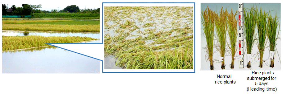
Figure 1. Flooded rice field in the vicinity of Kokai River in Ibaraki Prefecture due to heavy rainfall on Sep 10, 2015 and the condition of damaged rice plants based on the results of rice flooding test.
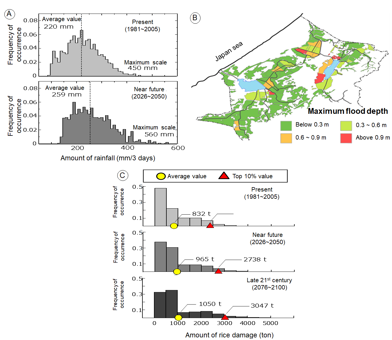
Figure 2. Examples of field evaluation in Kagasanko region, Ishikawa Prefecture
(A) The estimated intensity and occurence frequency of heavy rain is 1 in 10 years. Currently, the average is 220 mm and maximum of 450 mm, but the intensity is increasing in the future with an average of 259 mm and maximum of 560 mm.
(B) Result of flood analysis due to heavy rain.
(C) Rice damage (risk) assessment results.
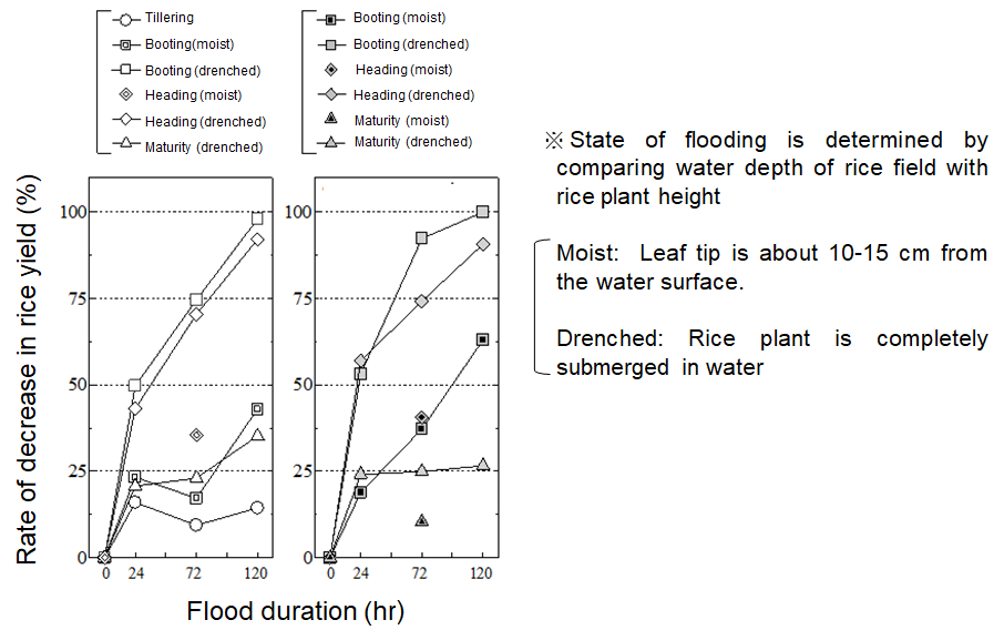
Figure 3. Decrease in rice yield based on demonstration test
The rate of yield decrease depending on conditions such as the rice growing time when flooding occurs, depth of the rice field, and duration of flooding can be easily estimated.